This website uses cookies so that we can provide you with the best user experience possible. Cookie information is stored in your browser and performs functions such as recognising you when you return to our website and helping our team to understand which sections of the website you find most interesting and useful.

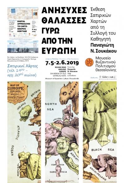
ROUGH SEAS AROUND EUROPE Exhibition of Satirical Maps from the Panayotis Soukakos Map Collection
07.05.2019 - 02.06.2019
Maps Exhibition with explanatory captions
The use of satire to comment on historic or current events by means of map representation, or by recruiting the map as an excuse to do so, is well-known and quite common in the history and practice of cartography — as satirical cartographical “anamorphoses” — as well as the history of sketching and the visual communication of ideas.
Our beloved satirical maps; an interesting branch of cartography, closely connected with the humanities, social and political sciences, geopolitics and international relations, visual communication and political messages, or even the art of sketching, when the need to express the content visually is connected both with the geographical area and its representation. Usually this happens with a comical-caustic or tragicomic intention, and in an allegorical-transcendental representational way, utilizing an interesting type of cartographic simulation, through the “anamorphosis” technique, sometimes in a more empirical way, and other times through knowledge.
Satirical maps constitute significant historical testimonies, which combine in a uniform complex representation, and in a technical and artistic way, the standards of cartographic visualization with those of the sketch; the satirical sketch, mainly the “comical” one, in the abstract sense of the word. They don’t necessarily aspire towards the hilarious, since a cartoon may provide opportunities for reflection and contemplation, as it usually happens with the political cartoons of the past, which in their time may have carried a hilarious element, but revisited later, they may lead to quite different reactions.
These maps, however, never cease to reflect the ideological background of their creators, and their critical stance against the sociopolitical affairs of their time. Nevertheless, they always center on the notion of “power,” which most of the time is biased, since they constitute a satirical reproduction of the stereotypes that befit the “opponents” rather than the “friends.”
Evangelos Livieratos
“Between representational art and ideological influence”. In: Satirical Maps. Historical and Satirical Accounts of Europe (19th-20th century), P. N. Soucacos (Εd.), Athens: Miletos ,2015, ISBN 978-960-464-690-6.


